
Zombies Arent Real Height View: Read the Map
The H key in Zombies Arent Real turns the city into a block model. Use it to pick sniper roofs, read terrain and stop wasting the first budget.
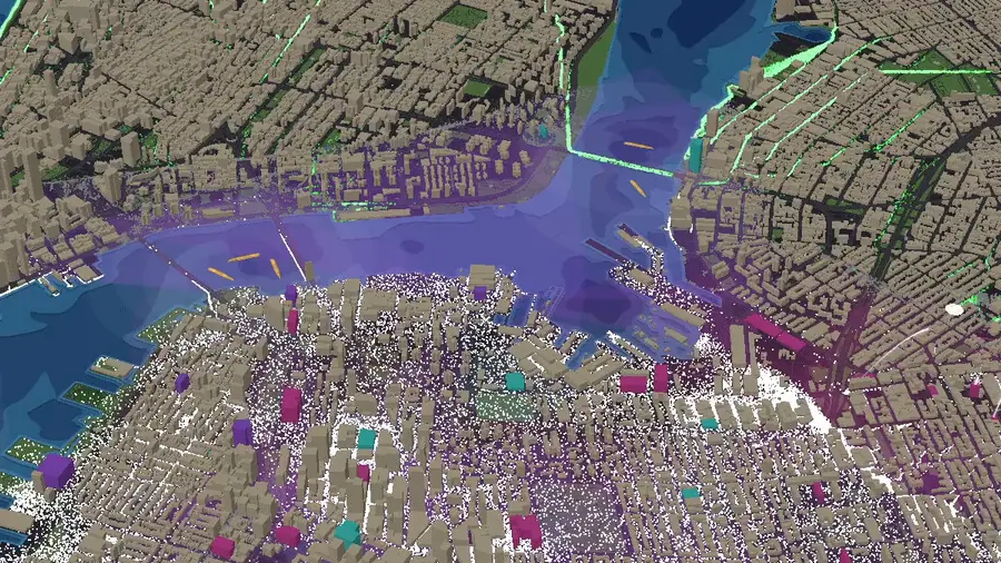
The H key is the most important control in Zombies Arent Real and the one the game explains least. It switches the city into a three-dimensional block view: buildings rise, terrain steps, and the flat map becomes a landscape with roofs, streets and water at different levels.
Use it before you spend anything. The planning phase is untimed, and the height view is the only way to see what your units will actually be able to see.
What the height view shows
Roof height. On the flat map, every building is a rectangle. In the height view, the tall ones are obvious, and tall buildings are where snipers live.
Terrain steps. Cities are not flat. Even a small elevation change decides whether a street is visible from a roof or hidden behind the next block.
Water. Rivers and harbours become hard walls rather than blue streets, which is the correct mental model: the horde cannot cross water, and neither can your corridor.
Building density. Dense grids read as a block of doorways, which is exactly what garrisons need. Wide avenues read as the opposite.
Three decisions the height view makes for you
Where snipers go. A $35 sniper on the tallest roof with a clean junction out-kills units many times its price. The height view is how you find that roof in ten seconds instead of by trial and refund.
Where the mortar goes. Mortars need open ground beyond 160 m and a safe-zone cell under them. The height view tells you whether the placement has a clear arc or is shooting into a rooftop.
Where the horde actually goes. Streets between tall buildings are canyons: the horde travels them in single file and arrives later. Streets along open ground let it spread. That difference is the entire chokepoint logic, and it is invisible on the flat map.
Reading a skyline for sightlines
A roof is worth what it can see across. Three patterns repeat on every city map:
| Pattern | What it looks like in height view | Best use |
|---|---|---|
| Corner tower | Tall block at a junction of two or three streets | Two or three snipers, overlapping arcs |
| Long terrace | Row of mid-rise along a single street | One sniper, narrow but deep sightline |
| Low-rise district | Wide flat blocks near water | Bad for snipers, good for mortars and garrisons |
| River canyon | Tall blocks on both banks | Crossfire onto the bridge approach |
If a roof only sees one street, it is a checkpoint. If it sees three, it is worth buying twice.
Terrain, corridors and the civilians
The height view is also the fastest way to plan the evacuation. A corridor at $0.40 per length runs along ground, and ground has shape.
- Uphill routes are slow. They are also easier to defend, because the horde strings out.
- Waterfront routes are exposed. The horde has fewer directions to arrive from, which is good, but there is nowhere to fall back to.
- Canyon streets are corridors already. A route through a canyon needs fewer units than a route across open ground.
Look for the route that ends at a map edge with the fewest open flanks, then draw the corridor along it. That single decision is worth more than most unit purchases.
The two-pass habit
The height view is not a one-time inspection. Use it twice:
- Before spending. Find the roofs, the crossings and the route.
- After the first breach. Switch to height and look at where the horde actually came from. It is almost never where you thought on the flat map.
Both passes are free, both take under a minute, and together they replace most of the guesswork in a run.
Workshop maps change the skyline
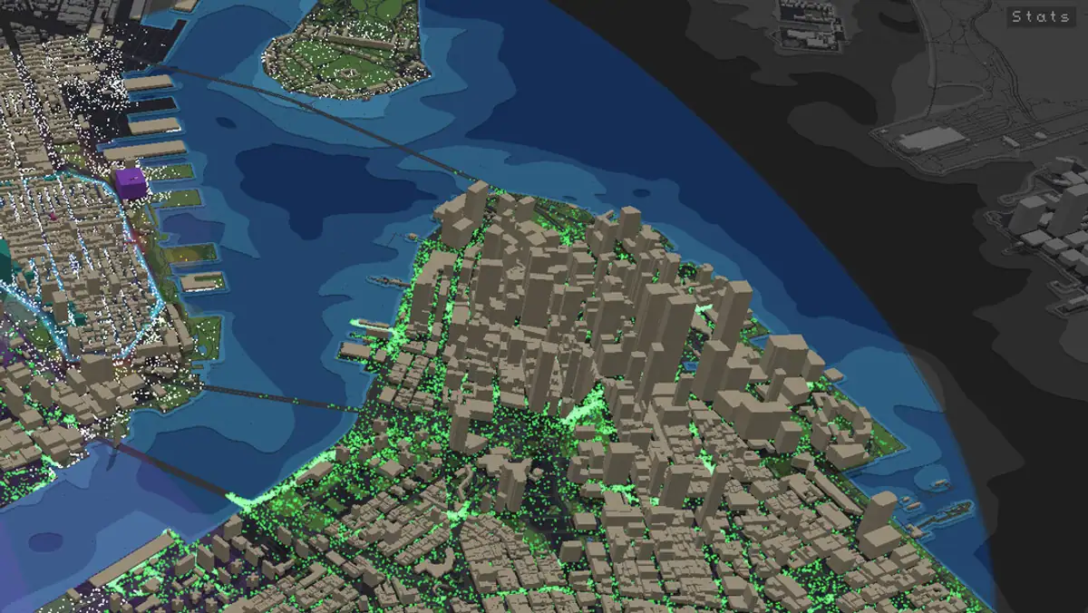
Custom maps from the Steam Workshop are built in the in-game level editor, and they can produce skylines that the real-city maps never would: towers with no street access, water where a road should be, elevation steps that create unintended sightlines.
On a workshop map, spend the first planning phase purely on the height view. The geometry is not a real city, so the real-city instincts that work elsewhere will mislead you about where the funnels are. The workshop guide → covers the editor side.
Pause with Space, switch to height with H, and study the last thirty seconds of a breach from a new angle. It is the cheapest way to learn what your layout actually did.
Official source: Steam store page ↗ · Steam Community hub ↗ · SteamDB ↗
FAQ
What does the H key do in Zombies Arent Real?
It toggles the height view, a three-dimensional block rendering of the city that shows building height, terrain and water depth relative to the streets.
Does height affect gameplay or is it only visual?
It affects sightlines and path speed: tall buildings block lines of fire and channel the horde into canyons, which is why roof selection and funnel placement both depend on it.
Can I use the height view during a fight?
Yes. It is a view toggle, not a planning-only tool, and pausing to check it mid-run is normal play.
Do heights matter on workshop maps?
More than on the city maps, because custom maps can be built with geometry that has no real-world logic behind it.
Which key shows the class list?
J opens the class list, and H toggles height. Both sit in the same view panel at the bottom right of the deployment screen.